
The landscape along Nakatsugawa in Akiyama District is significantly shaped by its geological and environmental vulnerabilities. Slopes adjacent to Nakatsugawa are particularly susceptible to collapses, erosion, and landslides, often triggered by melting snow. These phenomena lead to the accumulation of large rocks and sediment along the valley, impeding the river flow and continually reshaping the riverbed and banks, thereby drastically altering Nakatsugawa’s course.
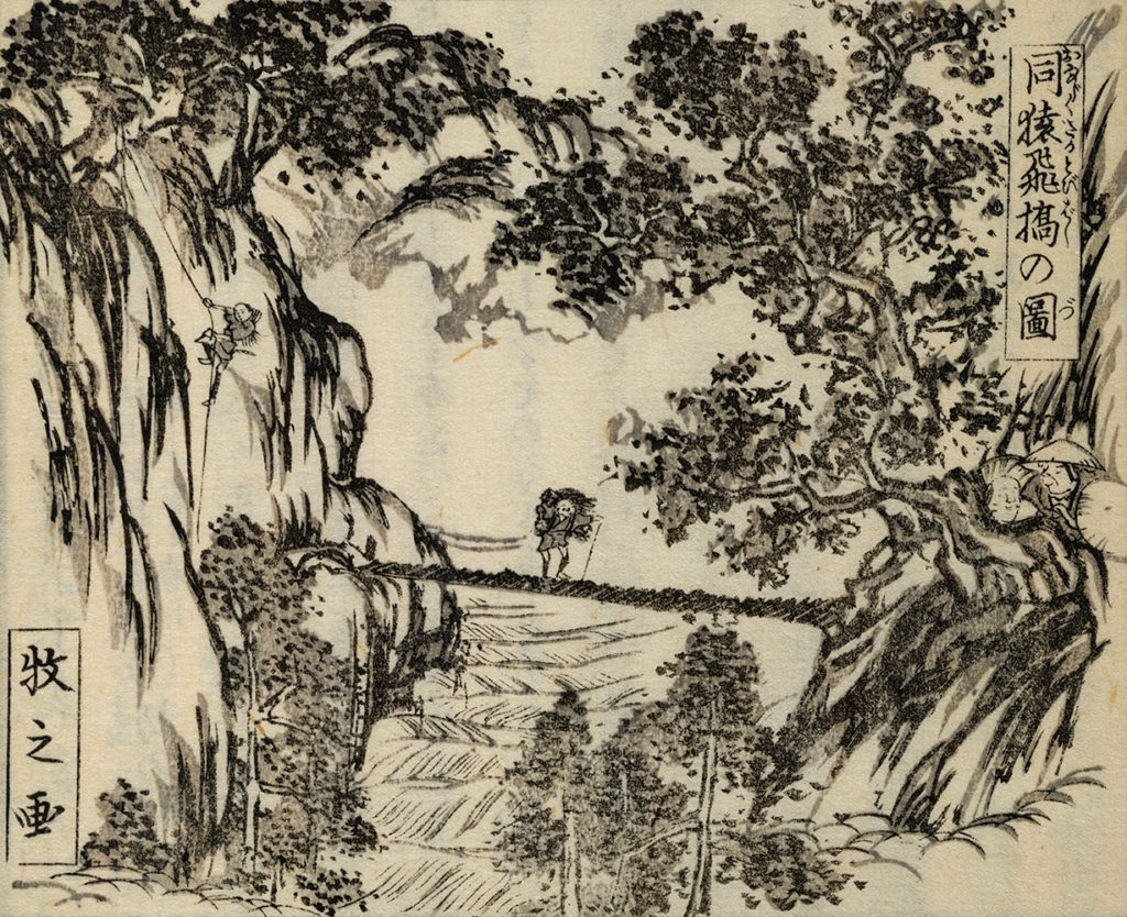
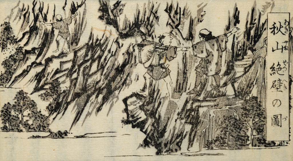
Collapsing terrains along the river have transformed into steep cliffs, with remaining boulders contributing to the formation of precipices and narrow valleys, vividly illustrated in Suzuki Bokushi’s “Picture of Akiyama’s Cliffs” and “Picture of Sarutobi Bridge” from his “Hokuetsu Seppu.” Such natural formations have historically obstructed travel through this region. As a result, the Nakatsugawa River in Akiyama boasts numerous riverbeds and valleys of various sizes, creating a winding path through the district.
Located upstream of a constricted valley near Sarutobi Bridge, Shimizugawara possesses a prominent riverbed along Nakatsugawa. Historical aerial photographs and maps from the Geospatial Information Authority of Japan suggest that prior to 1960, the river meandered significantly under the northwestern slope, forming a large mid-channel. This path has since been filled with slope-derived sediments and has evolved into a forested area.
Aerial images from the 1960s show remnants of this meandering course, but by 1977, these smaller channels had vanished. The contemporary flow now adheres closely to the forested area’s borders, representing the central channel of the mid-channel and the current main channel, resulting in a reduced mid-channel size.
Aerial views from 2016 reveal only remnants of stones and gravel from the former river in this central mid-channel section, with the flow now confined to the terraced course. This reflects a gradual southwesterly migration of the Shimizugawara course. Although the current flow mirrors that of 2016, the existence of multiple traces of old channels on the mid-channel indicates potential subsurface flows or channels that activate during heavy rains.
Before 1820, and specifically before the completion of the Norikura Dam upstream of Nakatsugawa by Tokyo Electric Power Company in 1956, Suzuki Bokushi’s era showed a significant meandering course on the northwestern side, similar to observations from the 1960s. During that period, the river exhibited higher flow rates and faster currents, with many watercourses on Shimizugawara’s mid-channel, each broader and featuring a more expansive water surface.