
English version is available here.
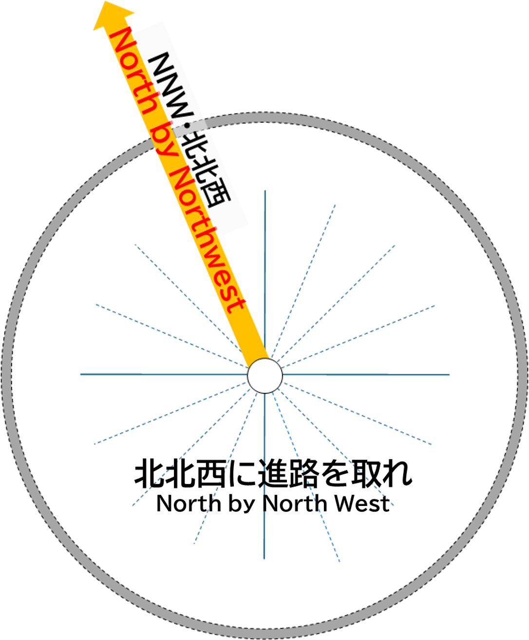
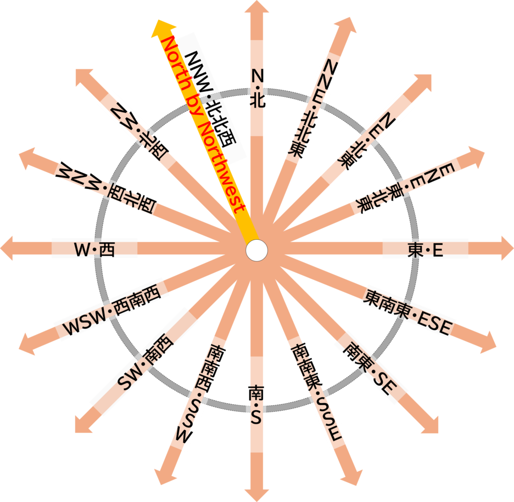
北北西
地球は絶えず流動し変化し関連し合う大気圏、水圏、生物圏、地圏から成り立っています。それらは様々な自然現象となって人々の生活や社会経済活動を支える一方で、自然災害を生じさせるなど、人間活動に対して可能性と制約をもたらす地域資源(それぞれの地域に固有の資源)となっています。地域資源は空間的にも時間的にも絶えず変化しています。
これらを理解するためには、自然を育んでいる地域(Meteorological Region/Hydrological Region)をトータルでとらえることが大切です。
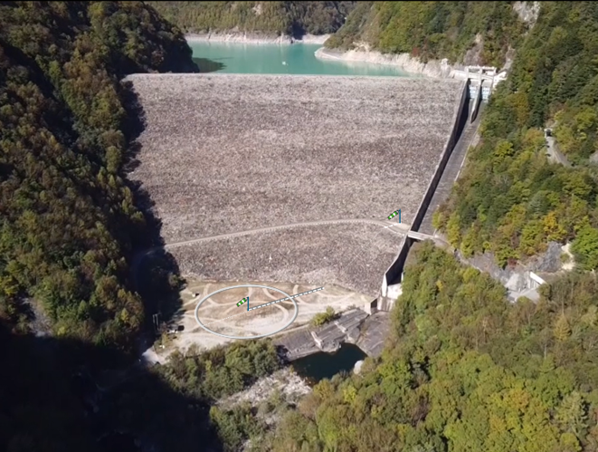
「不確かな風向」(北アルプス国際芸術祭2020-2021)では、偏西風などの季節風が飛騨山脈(北アルプス)を越え、七倉ダムの斜面を吹き下ろす、または、吹き上がる際の高瀬川流域の風の変化を検証し、ダム下端広場に視覚化しました。
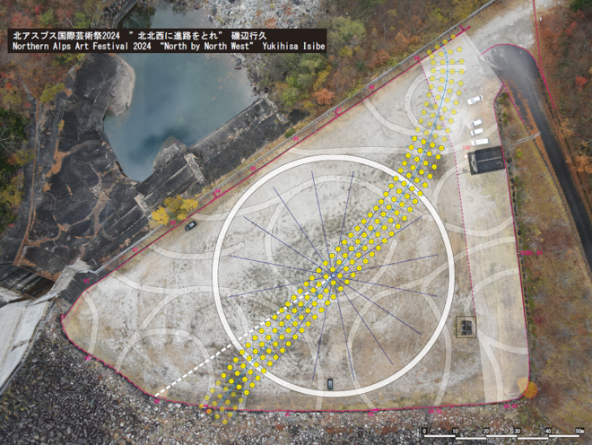
北アルプス国際芸術祭 2024では、高瀬川の流れと流域を越えて吹き下ろしている強い北西風が合わさることによる自然との関りを視覚化しています。この七倉ダム下端広場でのかつての高瀬川の流れは、北から-22.5°の方角(北北西)から流下していました。 この-22.5°(北北西)の線上には、黒部ダム・黒部川や富山湾を越えて能登半島の珠洲市が位置します。
黒部川からの水や土砂等は、北北西方向に流下し、富山扇状地を形成しながら富山湾に注ぎ、対馬海流や沿岸流の影響を受けながら日本海沿岸に及んでいます。高瀬川も千曲川と合流し、信濃川となって新潟平野や日本海に注いでいます。そのためHydrological Regionとしてのさまざまな繋がりがあります。
奥能登国際芸術祭2020+では、日本海に突き出た能登半島の先端を流れる「偏西風」や「対馬海流」が奥能登と他の地域とどのように関わってきたかを調査しました。珠洲市をはじめ奥能登地域は2024年1月1日の能登半島地震で甚大な被害を受けました。
高瀬川峡谷と七倉ダムに囲まれたこの地点に立って、奥能登地域など見えない地域との自然的・空間的な関りに思いを巡らせ、意識していくことが重要です。こうした諸点を踏まえ、今回は「北北西に進路をとれ」として、七倉ダム下端広場からの方位に着目し、高瀬川流域や地域を越えたMeteorological RegionやHydrological Regionとの関わりをこのプロジェクトの視点としています。
NNW
The Earth is composed of continuously flowing, changing, and interconnected spheres: the atmosphere, hydrosphere, biosphere, and lithosphere. These spheres, while supporting human life and socio-economic activities through various natural phenomena, also act as regional resources (unique to each area), bringing both opportunities and limitations to human endeavors by potentially causing natural disasters. These regional resources are constantly changing both spatially and temporally.
To fully understand these dynamics, it is essential to view the natural environment as an integrated whole, considering the regions that nurture it, such as Meteorological Regions and Hydrological Regions.
In the “Uncertain Wind Direction” (Northern Alps International Art Festival 2020-2021), the changing winds of the Takase River basin, which are influenced by seasonal westerlies crossing the Hida Mountains (Northern Alps) and blowing over the slopes of the Nanakura Dam, were examined and visualized at the dam’s lower plaza.
For the Northern Alps International Art Festival 2024, the project visualizes the interaction between nature and the strong northwesterly winds descending over the Takase River basin. Historically, the flow of the Takase River at the Nanakura Dam lower plaza followed a course from the north-northwest at an angle of -22.5°. Along this same line lies Kurobe Dam, the Kurobe River, Toyama Bay, and finally the city of Suzu on the Noto Peninsula.
Materials like water and sediment from the Kurobe River flow north-northwest, forming the Toyama alluvial fan before entering Toyama Bay. There, they are further influenced by the Tsushima and coastal currents, extending their reach along the coast of the Sea of Japan. Similarly, the Takase River merges with the Chikuma River, becoming the Shinano River, which then flows through the Niigata Plain into the Sea of Japan. This creates numerous connections within the Hydrological Region.
In the Oku-Noto Triennale 2020+, we studied how the westerlies and Tsushima Current flowing around the tip of the Noto Peninsula, which juts out into the Sea of Japan, have historically interacted with Oku-Noto and other regions. The Oku-Noto area, including Suzu City, suffered significant damage in the Noto Peninsula earthquake on January 1, 2024.
Standing at this location, surrounded by the Takase River Gorge and the Nanakura Dam, it is vital to contemplate the natural and spatial connections with unseen regions like Oku-Noto. Taking these points into account, this project, titled “Set a Course for North-Northwest,” focuses on the directional orientation from the Nanakura Dam lower plaza and explores the connections between the Takase River basin, the Meteorological and Hydrological Regions beyond.